
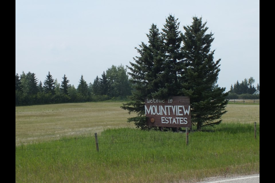
A proposed subdivision of 180+ lots against the fence line of existing residences on Trails End Road and Mount View Estates on the north end of town has some area residents up in arms before the formal application has even been completed.
The site is situated in Rocky View County (RVC), on a rural edge of the Cochrane North Area Structure Plan directly adjacent to the municipal boundary of the Town of Cochrane.
The opponents, who’ve spread their views through notices on postal super boxes in and around the area, are calling the Magna Vista proposal a “high density subdivision” that will have a negative impact on the environment, community character, traffic congestion, water and wastewater.
And it will disrupt their view of the mountains.
In an interview, the creators of the posters told The Eagle they’re not ready to go public with their names yet, but are urging like-minded individuals to engage in letter writing and phone calls now, before the community engagement process begins.
The redesignation of the land use is the next step in the process.
The County’s process begins with a landowner or developer submitting a redesignation application to the RVC Planning and Development Services. The RVC planning team reviews the application and public notifications and consultations are then conducted to gather feedback from local residents and stakeholders, ensuring community concerns are considered. After thorough evaluation, the application is presented to the RVC Planning Commission for recommendations.
Once the Planning Commission reviews the application, it is forwarded to the RVC Council for a final decision. During this stage, the council holds public hearings where residents can voice their support or opposition to the proposal.
The developers do not refer to it as “high density.”
According to the Magna Vista Conceptual Scheme filed with the County, the Plan Area is expected to achieve a total of 208 residential units, with a residential density of 1.25 units per gross acre (2.8 units per gross hectare). Gross density includes lands dedicated for roads, public utility, environmental reserve and open space. This proposed development will accommodate an anticipated future population of approximately 540 residents.
According to the Scheme (which the County advises is not final) the new development would allow for “Residential, Mid-Density Urban District (R-MID) and Residential, Small Lot District (R-SML).”
A Transportation Impact Assessment (TIA) concluded the existing network can accommodate the increased traffic from the proposed developments, with additional infrastructure improvements needed to support anticipated traffic levels.
A Wetland Assessment and Impact Report (WAIR) for the subject lands is being prepared. The field assessment for the Report is currently pending. A comprehensive desktop review has been completed, and a field assessment will be completed in the spring/summer of 2024 and report results will be submitted as part of a formal resubmission.
Another outstanding item is a review under the Historic Resources Act, to ensure compliance.
Bearspaw residents recently opposed the Ascension development application for redesignation. Amid strong community opposition, RVC Council unanimously rejected the development proposal.


